|
76NEWS on 2014-02-25 04:23:29Project Endedby marina |
|
|
|
|
|
Welcome !
|
  
|
You are visitor no. 253015 since 10/14/2010 Visitors Online: 1 Members Online: 0
Page updated:
|
@NLINE APPLICATIONS.::.GEOMODELS.::.GravINSTAB
Cyberinfrastructure for Geodynamic Studies Related to the Vrancea Seismogenic Zone
GravINSTAB - Litospheric delamination due to density anomaly in the lower crust (eglogitization)
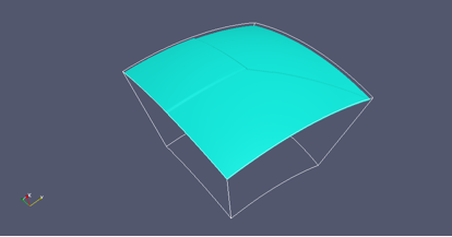
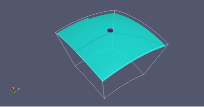
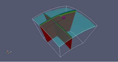
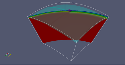
It is known that mantle lithosphere is more dense than the underneath asthenosphere if warmed to the same temperature, therefore it becomes gravitationally unstable. In case that horizontal shortening occurs between two more rigid plates or blocks of lithosphere, as is the case of Vrancea seismogenic zone where there are three lithospheric blocks with different thiknesses, the gravitational instability might enhance the thickening. Also the lower parth of the continental crust might undergo eclogitization, creating a potentially gravitational instability. Using the finite element package CitcomS.py Version 3.0.1 (Tan et al., 2006) available from the Computational Infrastructure for Geodynamics (CIG) (http://geodynamics.org), we include a region of eclogitization of 100 km in radius located at the intersection point of the three lithospheric compartments and between 20 and 40 km depth. The computations are performed within a 3D spherical domain (θ, φ, r), where θ is latitude, φ is longitude and r is radius (Fig. 1). The inner radius corresponds to a depth of 1900 km, the outer radius the surface of the Earth. The span in latitude and longitude is 28° and 28°. This domain is evenly divided into 65 elements in the radial dimension and 129 x 129 elements in areal (i.e., latitude and longitude) dimension, corresponding to a 25 x 25 x 25 km resolution. The boundary conditions are as follows. The top and bottom boundaries are assumed to be isothermal and free slip and the sides are reflecting. The initial thermal structure is described by a multiple age thermal boundary layers (see figures below) with old lithosphere as a 200 Myr and 130 Myr old plates and young lithosphere as 50 Myr old. The background mantle is divided into four layers: lithosphere (variable thickness), upper mantle (variable thickness), transition zone (410 - 670 km) and part of lower mantle (670 - 1900 km). The lithosphere has a variable thickness, ranging from 100 km for young lithosphere to 160 - 200 km for the oldest regions. The eclogitized (density excess of 600 km/m3) lower crust is modeled using particle tracers (see purple-magenta particles in the next figures).
|
 |
 |
Initial setup: position of the 500°C isotherm |
Initial setup: position of the 500°C isotherm and the position of the eclogitized lower crust (represented as magenta tracers or particles). |
 |
 |
Initial setup: position of the 500°C isotherm and the position of the eclogitized lower crust (represented as magenta tracers or particles) and two vertical cuts through the initial model. Colors represent temperature (0-1350°C). |
Initial setup: position of the 500°C isotherm and the position of the eclogitized lower crust (represented as magenta tracers or particles) and two vertical cuts through the initial model. Colors represent temperature (0-1350°C). |
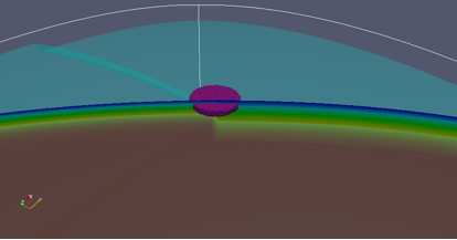 |
Initial setup: a zoom into the position of the 500°C isotherm and the position of the eclogitized lower crust (represented as magenta tracers or particles: 200 km in diameter and 20 km thick) and two vertical cuts through the initial model. Colors represent temperature (0-1350°C). |
|
|
|
|
|
|
|


