|
76NOUTĂȚI din 2014-02-25 04:23:29Project Endedby marina |
|
|
|
|
|
Bine ați venit !
|
|
Vizitator nr. 0 din 14/10/2010 Vizitatori @nline: 0 Membrii @nline: 0
Ultima actualizare:
|
PERSONAL
Infrastructură Cibernetică pentru Studii Geodinamice Relaționate cu Zona Seismogenică Vrancea
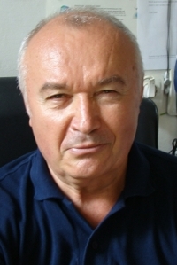 Dr. Lucian BesutiuDownload PDF_RODownload PDF_EN Dr. Lucian BesutiuDownload PDF_RODownload PDF_EN | CERCETARE
LONG RANGE CAREER RESEARCH INTERESTS:
Potential fields
Integration of Geophysics and Geology
Computer applications in Earth Sciences
Engineering and environmental targeted geophysics
MAIN AREAS OF ACTIVITY:
GRAVITY AND GEOMAGNETIC STANDARDS
- author of the Romanian National Geomagnetic Reference Network for the finalization of the ground vertical component geomagnetic map of Romania
- co-author of the Romanian National Gravity Reference Networks: design of the Romanian First- and Second-Order Gravity Reference Networks and adjustment of the Romanian First Order Gravity Network
- research for the integration of the Romanian gravity system into the Central Europe gravity standard (UNIGRACE project)
- author of the Moldavian National Gravity Reference Network
- comparisons between geomagnetic standards of Romania, Ukraine and Republic of Moldova (UKROMM project)
LARGE SCALE GRAVITY AND GEOMAGNETIC MAPPING
- co-author of the Romanian National Ground Vertical Component Geomagnetic Map
- research on the geomagnetic reference fields: geophysical meaning and algorithms
- research on the distortions in the large scale composite geomagnetic maps caused by the space-time evolution of the geomagnetic field (DYGEF project)
- author of the revised version of the Romanian National Airborne Geomagnetic Map (DYGEF project)
- PI for the achievement of the joint geomagnetic map of Romania and Ukraine across the northern Romanian state-border (DEEP project)
- PI for the achievement the joint geomagnetic map of Romania, Republic of Moldova and Ukraine in the Low Danube area (MAGLODAN project)
- Romanian representative in the World Digital Magnetic Anomaly Map (WDMAM) project
GEOPHYSICAL DATA ACQUISITION AND PROCESSING
- more than 10 years of field campaigns for regional geomagnetic mapping of the Romanian territory
- detailed geomagnetic survey for structural aims and magnetics for ore deposits
- special detailed magnetic prospecting for manganese ore deposits at Nsuta, Western Region, Ghana; particular research on doing geomagnetic data acquisition & processing in the geomagnetic southern hemisphere, close to the geomagnetic equator
- research aimed at finding & applying a specific methodology for shallow-water geomagnetic and gravity investigations within Danube Delta
- research aimed at finding and applying a specific methodology for underground detailed gravity investigations in mining areas
- research on the influence of the man-made noises on geomagnetic prospecting, and setting up a methodology for exploration in mining zones
MODELLING
Tentative attempts for modelling gravity and geomagnetic anomalies in various areas: North Dobrogea folded belt, the transition area between North Dobrogea on-shore and Black Sea off-shore, South Carpathians, the Tornquist-Teisseyre Zone, Vrancea zone, etc.
GEOLOGICAL INTERPRETATION OF GEOPHYSICAL DATA
Complex geological interpretation of various geophysical data sets in synergy with other available information (e.g. DTM, geology, tectonics, rock physics, deep wells, well logging).
TECTONIC & GEODYNAMICS STUDIES, INCLUDING SEISMOLOGY
The main research interest focuses on the unusual intra-continental intermediate-depth seismicity located in the bending region of East Carpathians, the so-called Vrancea zone. Among the research objectives are:
- outlining the major lithospheric contacts on the Romanian territory and their geophysical and geodetic monitoring
- research on the geophysical imprints of the Black Sea opening and its seismotectonic consequences for the NW inland
- research on the dynamics of the active faults located within the Black Sea NW inland on the Romanian and Ukrainian territories
- analysis of the intermediate-depth seismicity peculiarities (e.g. hypocenter location, focal mechanism, magnitude, energy released, space-time dynamics);
- research on the non-tidal gravity changes and their connection to Vrancea intermediate-depth seismicity
- crust deformation monitoring in the Vrancea zone using both space and ground geodesy
Among the main research results may be cited:
- design and achievement of a specific research infrastructure for monitoring lithosphere dynamics on the Romanian territory: the National Geodynamic Network, including a micro-net for the Vrancea region;
- design and achievement of the Baspunar geodynamic observatory aimed at monitoring dynamics of a major lithosphere contact: Peceneaga-Camena Fault
- a model for the Black Sea opening and evolution
- a coherent geodynamic model for explaining the unusual crustal seismicity of the Eastern MoP
- a new model for the Vrancea active seismic area, and implementation of the geodynamic concept of the unstable triple junction in the Romanian scientific literature
ENGINEERING GEOPHYSICS
UXO & other buried iron objects (research for cleaning platform area for calibrating airplane compasses at the Baneasa airport, Bucharest), buried pipes (Medgidia, Dobrogea), archeomagnetics (Zalau, Porolissum Roman castrum), cavities & underground waters (Slanic Prahova salt mine), etc.
|
|
|
|
|
|
|
|